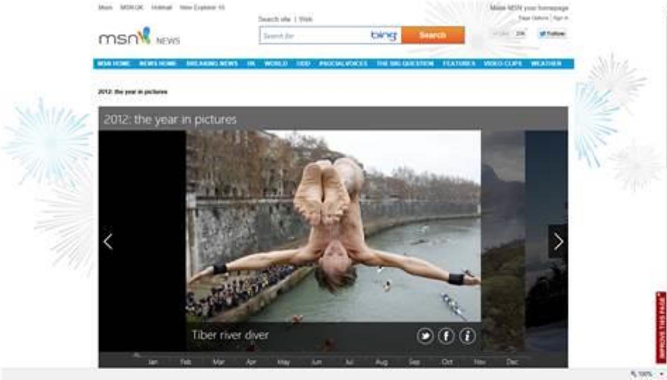
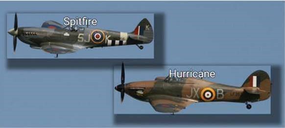
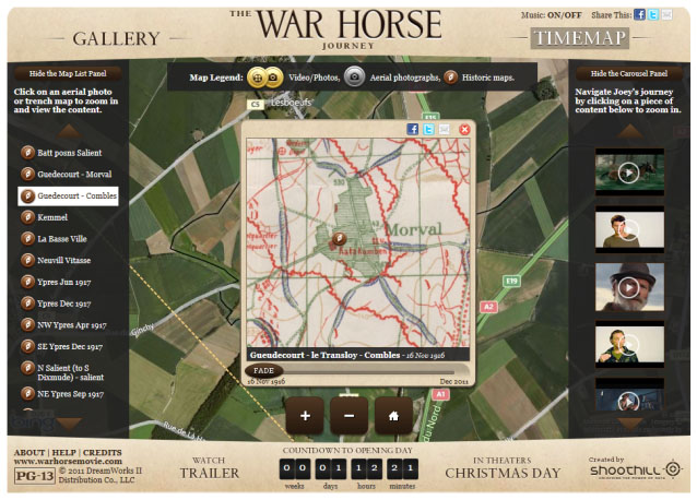
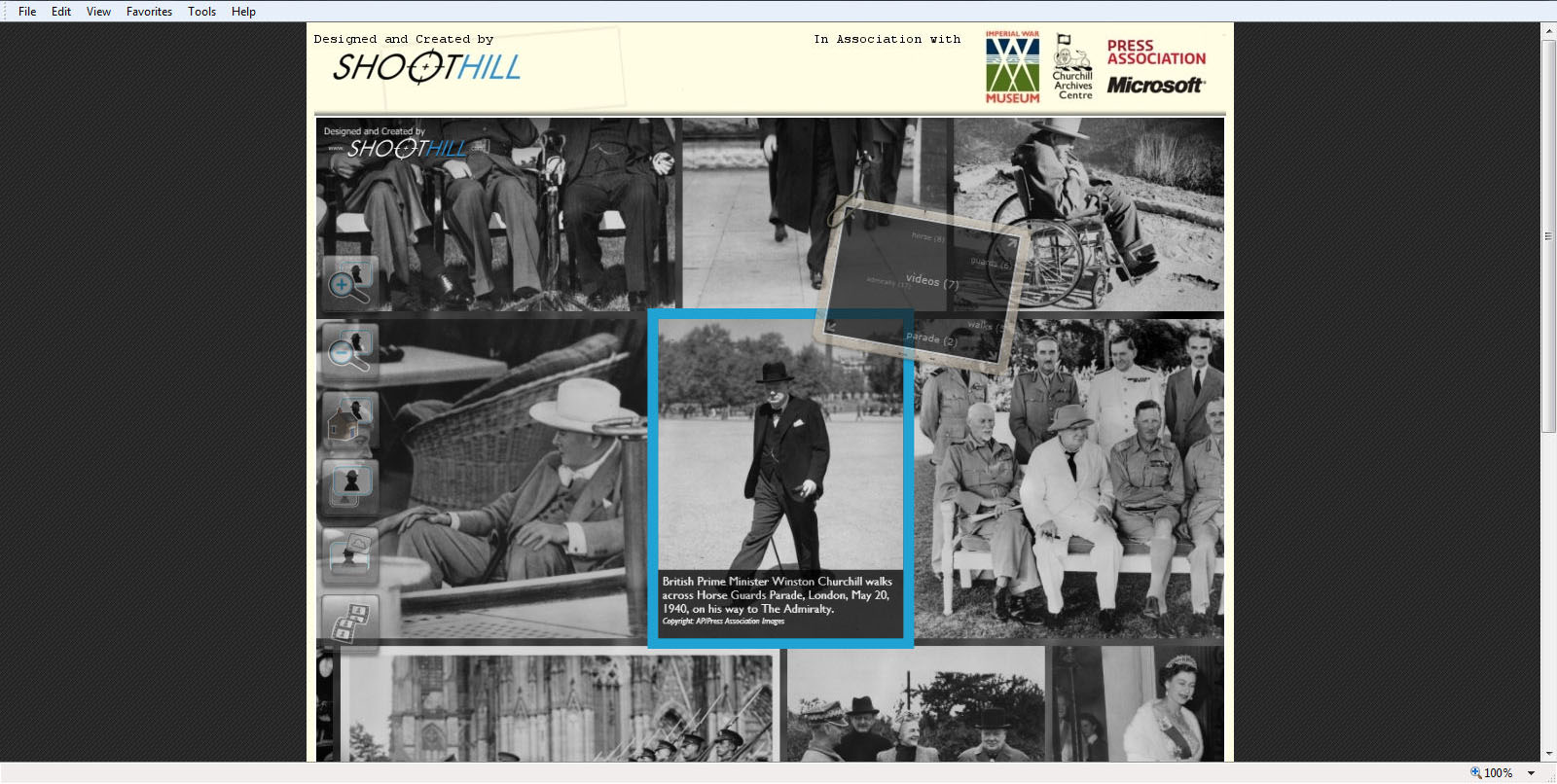
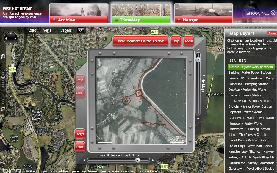
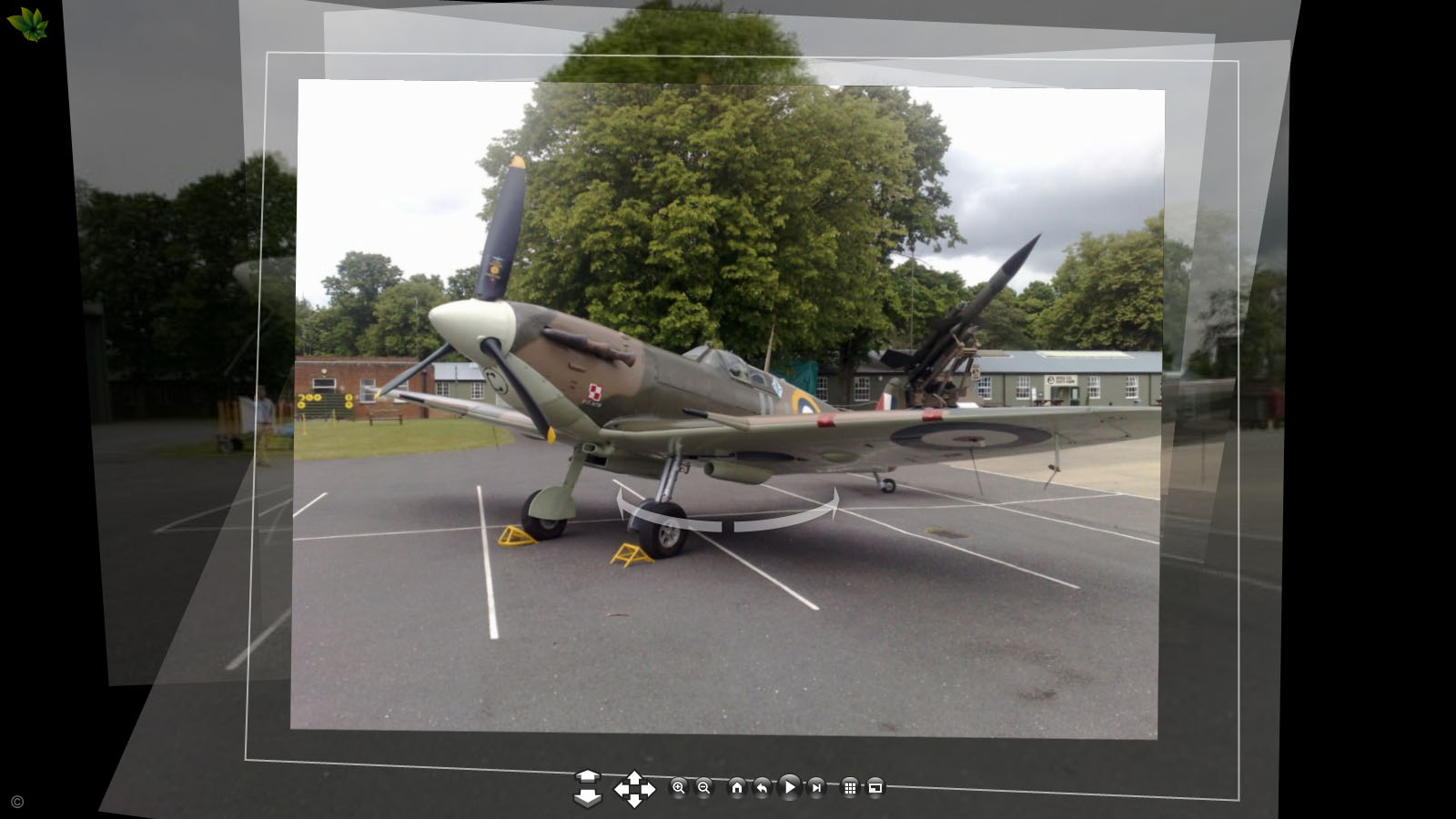
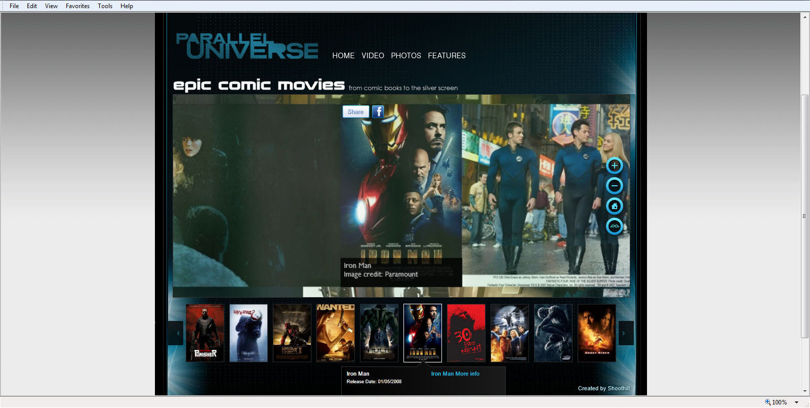
World War Two Battle of Britian
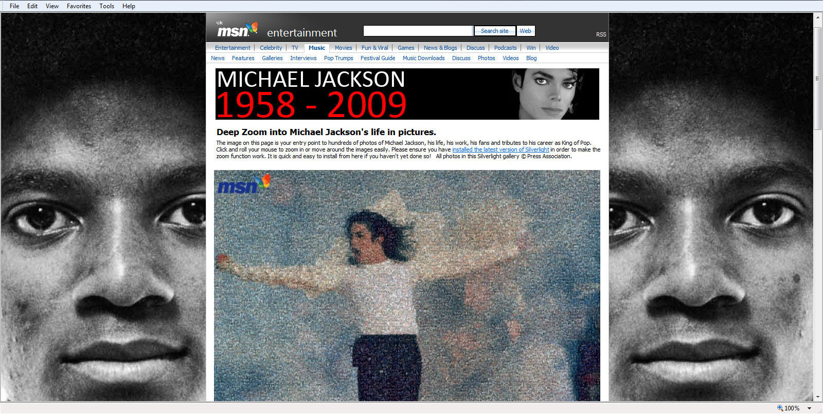
Based on our TimeMap concept, this exhibit displayed images of WW2 era artefacts, courtesy the Imperial War Museum. These included original WW2 maps, reconnaissance imagery, and target documents of London and Coventry from the German Luftwaffe. We also included the Photosynth’s of the Heinkel He 111, Supermarine Spitfire and the Hawker Hurricane we took earlier in the year in the ‘Hanger’ area of the site. Exhibited on MSN, this project remains one of favourites over the years, and was nominated for the AOP Awards shortlist in 2011