Fuelled by ideas from our design and planning team, Shoothill created My Flood Risk, a free and interactive web portal available to public users. The portal was designed with a high-quality UX (user experience) in mind, whilst manipulating data using cutting edge techniques to offer a comprehensive analysis of location specific flooding risk. Through this software we had provided a tool to raise awareness amongst at risk property owners of their vulnerability to damages.
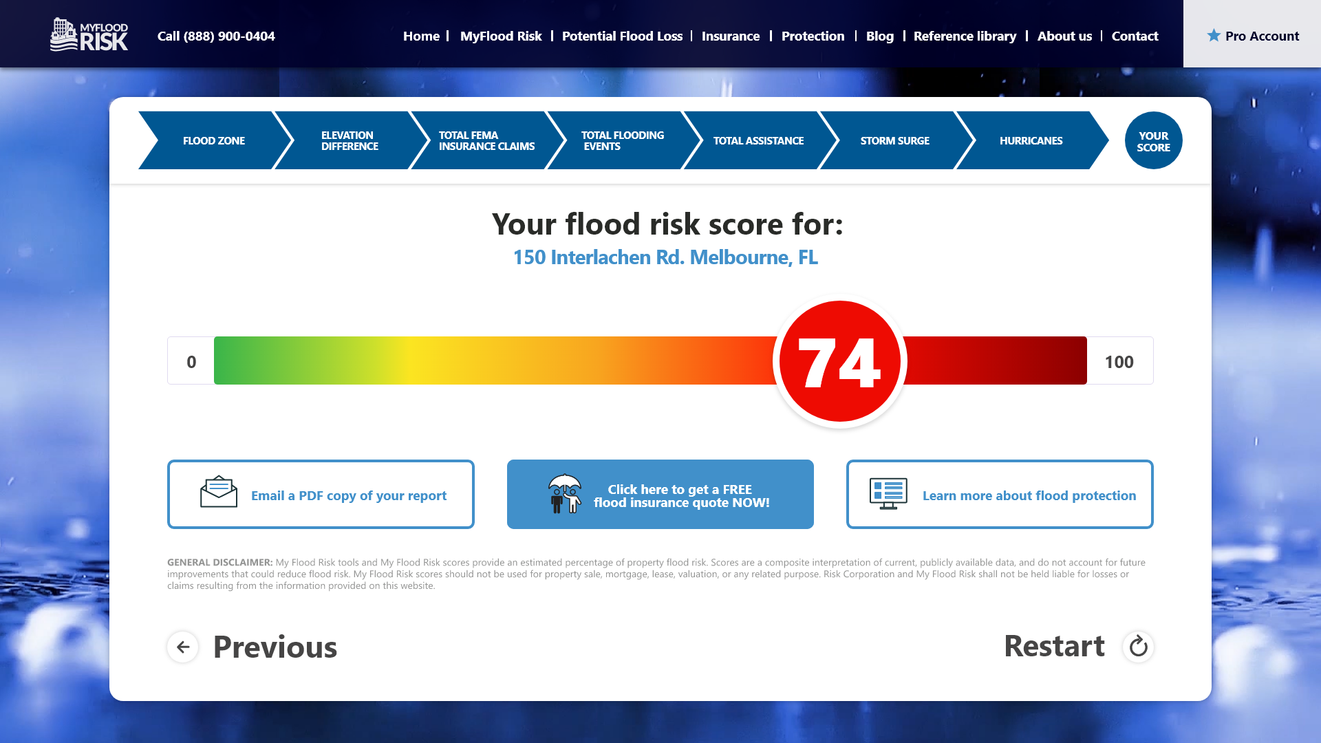
My Flood Risk locates the user’s property on an integrated map and generates a standardised Flood Risk Score as an overview statistic. This score is calculated using industry tried and tested methodology translated to a mathematical algorithm, which draws upon data from a number of sources as input for the computation. Ensuring that our data manipulation was up to date was a vital component of this solution, and so we curated a wide array of varied and highly complex data sets, and then processed them using the most effective methods to guarantee current and accurate outputs.
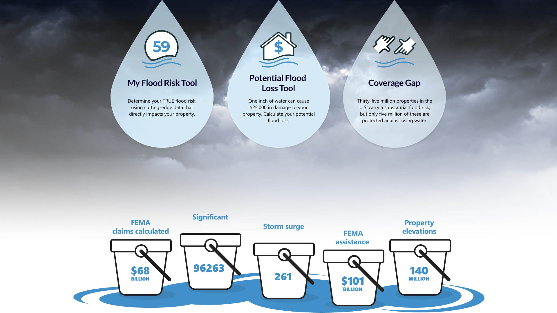
As previously stated, the preceding go-to for flood risk information was the government flood maps provided by the Federal Emergency Management Association (FEMA). The issue was that these maps were outdated, reliant on many obsolete methods and data sets, and failed to take into consideration many recently prevalent factors. In a changing climate, flood risk changes too, with increased snowmelt, heavier rainfall, higher storm surges and altered weather trends. Accommodating for these modern contributors in our data sourcing, analysis and interpretation resulted in system far more precise and up to date than its precursor.
As Microsoft silver partners we have access to a range of MS developer tools. Our programming team used an SQL server as a data source through API integrations, uploading directly to our database. Data storage is handled through cloud computing using the Azure hosting platform. Shoothill have amassed a large portfolio of original tools, routines and functions available through Azure which we can implement for fast development of software solutions such as My Flood Risk. Through expert application of C# and .Net Core we developed MFR into a fluid and efficient back end data manipulation tool, with a sleek front-end system coded in React alongside MobX.
The result is a web hosted portal with a variety of features. Primary amongst these is the wizard tool which breaks down for the user the relevant factors to our flood risk score. Having determined the user’s location in the USA the system provides them with their FEMA flood risk band but reiterates that this scale cannot be trusted as it is an outdate standard. This point is illustrated by visualising local flood levels against their property’s elevation, and flood history by state and county. Animated diagrams display the data in terms the average person can quickly interpret, with further written detail adjacent.
We also track meteorological history as an indicator of potential flood risk and offer users a timeline to demonstrate the proximity of Hurricane’s to their property. Hurricanes are a leading cause of flood in America, with both high rainfall and storm surge rising water levels and causing damages. For example, Hurricane Harvey flooded hundreds of thousands of homes when it made landfall in 2017, yet the majority of victims had been informed they lived in low flood risk areas. Tracking and displaying hurricane activity is a necessary step in determining true flood risk.
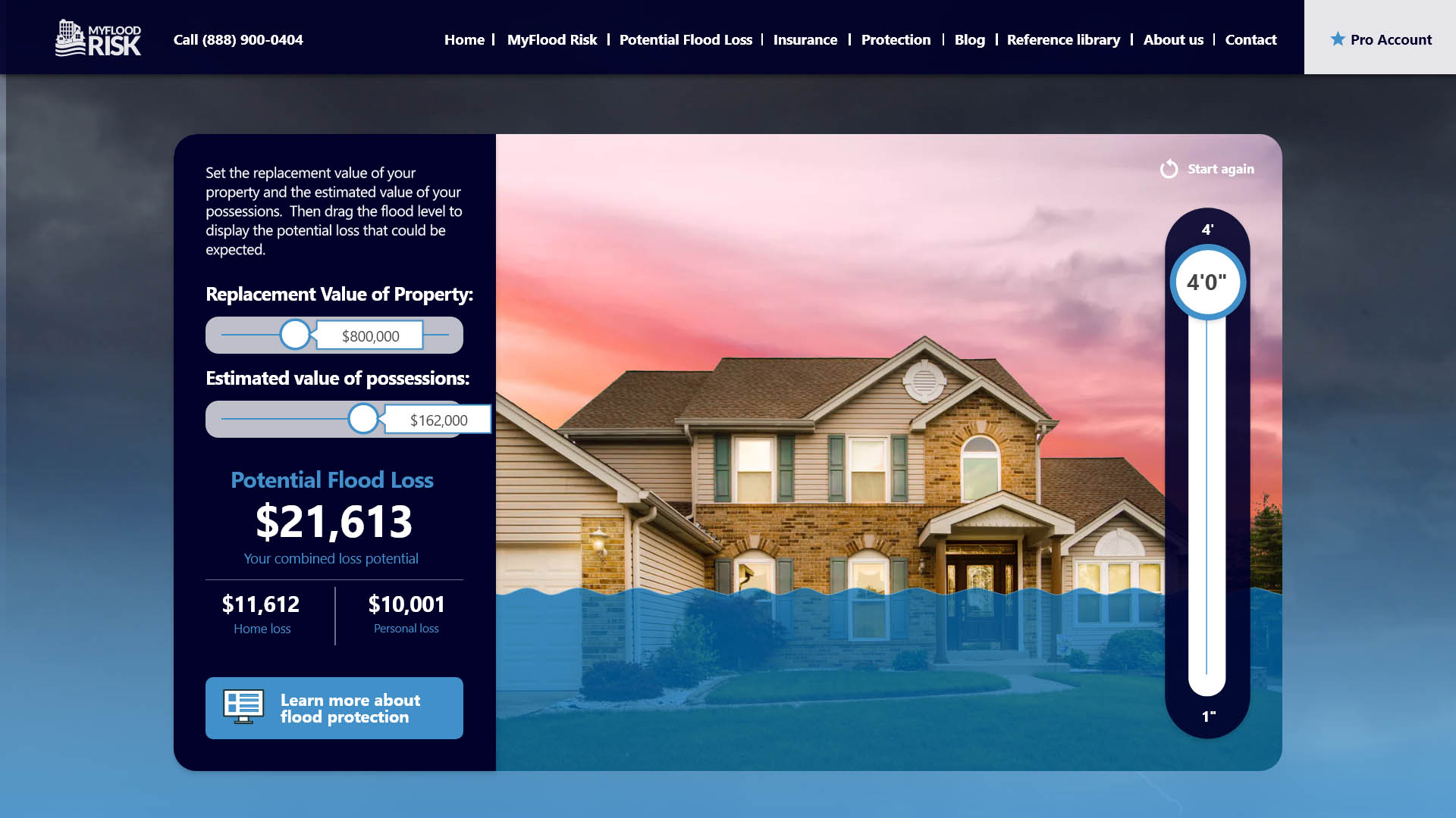
Before summarising the user’s flood risk with their score, calculated from these data sets, the system also translates the risk to the financial repercussions, with totals given for previous insurance claims and assistance pay outs in the local area, as indicators of the monetary loss they stand to experience. For further feedback relating to the economic impact of flooding, an additional feature available on the site is an interactive cost of flooding tool, where the user can operate sliders to their property’s specification and gauge the potential damages.
With resources available through the platform, including links to flooding insurers, support for flood preparation, and various relevant curated articles, My Flood Risk spreads awareness, whilst both encouraging and empowering disaster management.